GeoSpy is a cutting-edge AI technology that specializes in geo-estimation and location prediction, using pixel data to reliably determine geographical locations. GeoSpy Pro is exclusively available to authorized law enforcement, investigators, government agencies, enterprise users, and journalists. GeoSpy Pro employs AI algorithms to extract unique information from photographs and compare it against previously learned geographic locations, countries, and cities. GeoSpy can locate areas based on details that are invisible to humans.
What are the features of GeoSpy?
- Geo-estimation.
- Location prediction.
- Identifying background details.
- Time-based analysis.
- Identifying environmental details.
- Batch processing.
- API available.
What are the use cases of GeoSpy Pro?
Law enforcement
- Identifying crime scene locations.
- Tracking missing persons.
- Investigating online threats.
Journalists
- Verifying user-generated content.
- Investigative reporting.
Government agencies
- Monitoring border security.
- Disaster response.
Investigators
- Missing Person Investigations.
- Crime Scene Investigation.
GeoSpy will find you with a single photo and AI! (Source : Youtube Channel : Flipped Classroom Tutorials )
What are the pros and cons of GeoSpy?
Pros of GeoSpy
- Enhanced location analysis.
- Faster processing.
- Improved efficiency.
- Verification tool.
- Broad applications.
Cons of GeoSpy
- Limited access.
- Accuracy dependence.
- Human expertise is still crucial.
- Privacy concerns.
- Cost.
How does GeoSPy Pro work?
Step 1: Collect and import massive amounts of pictures for batch processing. Photos are processed in seconds.
Step 2: Learn important insights from your data, such as outliers, patterns, and features.
Step 3: Determine the when, where, and why hidden inside pixels.
What can GeoSpy Pro do?
- Pinpoint locations from photos.
- Analyze background details in photos for clues.
- Track changes in locations over time through multiple photos.
- Quickly process large amounts of photos.
GeoSpy Pro: Unlock Hidden Locations & Track Changes in Photos (AI-Powered)
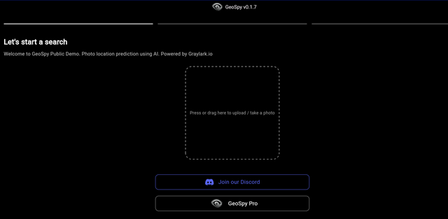
Step1 : Upload your Image/ Take a photo

Step2 : Get the Photo Geolocation results in map

In the above screenshot, we have uploaded an image of an iPhone. The results show details of the country and state where the image was taken, estimated coordinate details, and an explanation of the image along with an output on the map.
 GeoSpy pricing 2025: Plans, Features, and Subscription Costs Explained
- GeoSpy offers both free and paid plans.
- GeoSpy Pro usage plan is custom.
 GeoSpy Reviews & Ratings: See What Users and Experts Are Saying
 GeoSpy FAQ: Learn How to Use It, Troubleshoot Issues, and More
GeoSpy is an AI technology specializing in geo-estimation and location prediction.
GeoSpy Pro is an advanced version of GeoSpy exclusively available to authorized personnel like law enforcement, investigators, journalists, and government agencies.
GeoSpy Pro pricing plan is custom.
Yes, GeoSpy offers a free plan for users.
Common image formats like JPEG, PNG, and TIFF are likely supported by GeoSpy Pro.
Some alternatives to GeoSpy are Google Cloud Vision API and Amazon Rekognition.
GeoSpy Pro is restricted to authorized users such as law enforcement, investigators, journalists, and government agencies.
GeoSpy Pro's accuracy depends on the quality of the photos and the availability of relevant data for its AI.
 Summary
GeoSpy is an AI-powered geospatial intelligence platform providing satellite and drone imagery analysis, object detection, and location-based insights.


